Certified Master Naturalist, Ed Coleman, submitted this article on the Virginia Birding and Wildlife Trail Adoption project. Please contact him if you are interested in picking a site to visit periodically to collect data on wildlife.
Adopting the
Sweet Mountain Laurel loop of the Virginia Birding and Wildlife Trail.
Late in
2019, I volunteered to be the Adopt-A-Trail coordinator for the Sweet Mountain
Laurel loop of the Virginia Birding and Wildlife Trail (VBWT). The Virginia
Department of Wildlife Resources (DWR) created the Adopt-A-Trail project to
help maintain the VBWT. I specifically requested
the Sweet Mountain Laurel loop due to my familiarity with the area and the unique
biodiversity found on the Blue Ridge plateau. The 13 sites on this loop are located on or near the
southern portion of the Blue Ridge Parkway in Virginia. The drive from site to
site is almost as amazing as the sites themselves; the Blue Ridge Parkway
offers spectacular vistas, with overlooks stationed every few miles. The
Sweet Mountain Laurel loop provides
a nice amalgam of private and public lands, outdoor recreation, and includes Mabry
Mill, Chateau Morrisette, Rock Castle Gorge, and Buffalo Mountain Natural Area
Preserve, among others.

Saddle Overlook, Photo by Ed Coleman
Since the Sweet Mountain Laurel loop had not been
previously adopted, there was a lot to do as a trail coordinator before
starting fieldwork. While verifying that
weblinks opened the appropriate page on the Sweet Mountain Laurel loop website was
an easy at home activity, tracking down site contacts for updates to site specific
content proved more challenging given the time that had elapsed since the site
owners initially signed up. Two of the
Bed & Breakfast sites on the loop had permanently closed and owners of two
of the privately-owned sites no longer wanted to participate. Other site owners were eager to remain in the
program but were consistent in their feedback that the VBWT program needs further
promotion to bring visitors to their sites. As there had been numerous VDOT projects since
the Sweet Mountain Laurel loop was established, revisions to the driving
directions as shown on the loop’s webpage were required as well to ensure
visitors find their destination.

Undoubtedly,
the fun part of the Adopt-A-Trail project is viewing wildlife and documenting observations,
which I did for the first time in July. For the VBWT Adopt-A-Trail project, recording wildlife
observations is done using eBird and iNaturalist. Unless you are Mary Foster, wildlife observers
may have trouble identifying birds to log in eBird. For the sites in the Sweet Mountain Laurel
loop, I opened the eBird hotspot for each site in advance of my site visit,
looked for the most commonly recorded birds at the site during July, and then
focused on learning to identify those specific birds. With limited success, I
also experimented with two mobile apps that help to identify birds by sound.


Eastern Tiger Swallowtail (Papilio glaucus), Photo by Ed Coleman

Twin Spot Skipper (Oligoria maculata), Photo by Ed Coleman
Wildlife
observations are recorded under the Virginia Wildlife Mapping project on
iNaturalist. Insects can be a great go-to when observers just cannot seem to
find the more picturesque amphibians, mammals or reptiles at a site. Fortunately for me, July was bloom season for
common milkweed on the Blue Ridge, so butterflies such as Eastern Tiger
Swallowtail (Papilio glaucus) and Pipevine Swallowtail (Battus
philenor) were plentiful at several sites. When it came to identifying insects, I snapped
pictures with my iPhone using the Picture Insect app, instead of using a
dichotomous key. I admit that the app is
not always accurate, and results must be rechecked, but the identification
process is a lot faster and more accurate than using my dichotomous key skills.
Since
the Virginia Wildlife Mapping project on iNaturalist only accepts photos or
sound recordings, it’s best to keep camera in hand with finger on the shutter
release button when in the field. I
missed a nice shot of a northern water snake at the DeHart Memorial park wetland
bog and at least a dozen dusky salamanders on Rock Castle Creek. But, was
fortunate to snap a photo of a young Common Garter Snake (Thamnophis
sirtalis) on the Lower Rock Castle Creek trail and an Eastern Newt (Notophthalmus
viridescens) at Mabry Mill. The eBird and iNaturalist mobile apps make
recording of observations in the field easy, but the remoteness of the sites on
the Sweet Mountain Laurel loop means no cellphone service. So, my observations had to be uploaded at
home after completing the fieldwork.
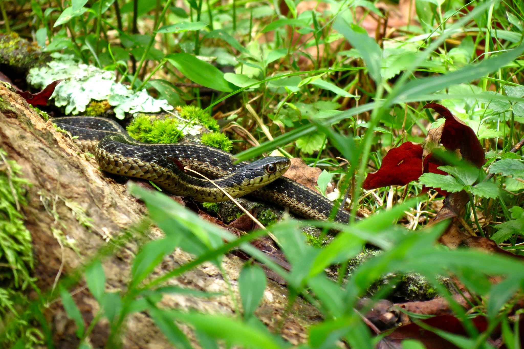
Common Garter Snake (Thamnophis sirtalis), Photo by Ed Coleman

DWR requests that website contacts, site descriptions, and driving
directions be updated annually for each site within the adopted loop, whereas wildlife
observations should be recorded quarterly. October is the next cycle for recording wildlife
observations on the Sweet
Mountain Laurel loop. If you are interested in volunteering by adopting
a site(s) within the loop, please let me know, as I could use your help. There is a site for every interest - from the
rugged Lower Rock Castle Creek trail to the easily accessible majestic overlooks
on the Blue Ridge Parkway to the simple elegance of Chateau Morrisette. Adoption of a site is an activity that can be
done at a social distance, with a fellow Master Naturalist or with family or
friends. Think about it, fall in the
Blue Ridge Mountains observing wildlife - it just does not get any better than
that. Check the loop out at https://dwr.virginia.gov/vbwt/mountain-trail/msl/


No comments:
Post a Comment